Inaccurate Points
Examples of cartographic spam on the web...

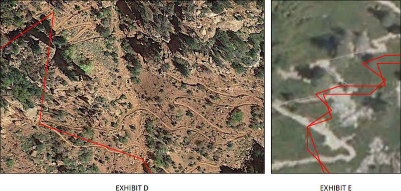
EXHIBIT D: This is an example of geofenced points; two of the only three points that represent this section of trail are inaccurate. Notice a mile of the same trail is not represented with points. This is a perfect example of cartographic spam on the Web. The visible trail in the aerial photograph is the Grand Canyon North Kaibab Trail. At the time of this writing, a search at google.com for "grand canyon rim rim trail" returns at the top of the first page search result, a reference to the page that displays these points. (The reference is a part of the organic search results.)

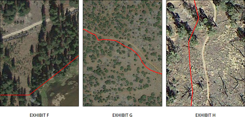
EXHIBIT F: This is an example of a route in California with inaccurate points. The points lead the hiker into a river, several hundred feet away from the visible trail. When the ground is featureless or visibility reduced, the person using these points in the field may die or become injured.
EXHIBIT G: This is a route with inaccurate points. I used this trail as an example to show the reader that overhead canopies and canyons are not responsible for the inaccurate points.

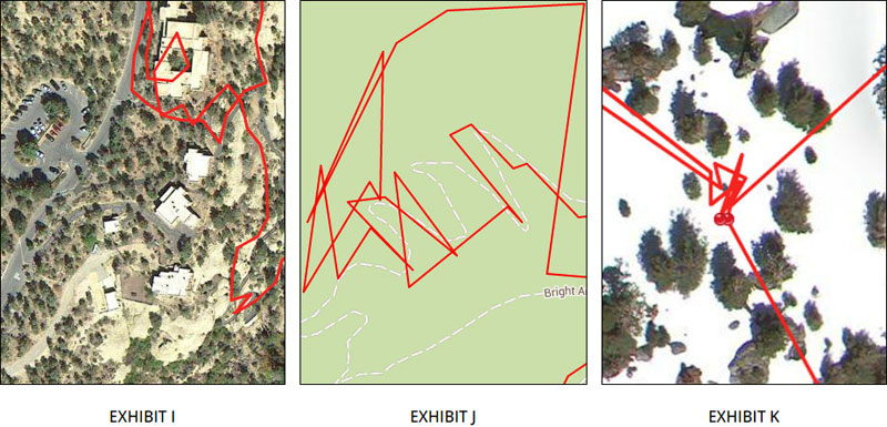
EXHIBIT I: Hiking trails do not loop through buildings, and the route does not follow a trail. I have visited this location several times, the points on this map are just complete garbage.

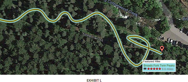
EXHIBIT L: This is a good example of inaccurate points which were simplified and then smoothed with a Bezier Curve. While the result is an artistc polyline, it does not depict the trail with any level of accuracy, making the information completely untrustworthy. Is the length of the hike really 9.6 miles, or is that the length of the polyline with inaccurate points?
