Bunkhouse Trail,
Red Rock State Park
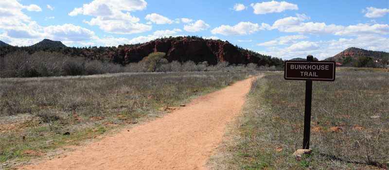
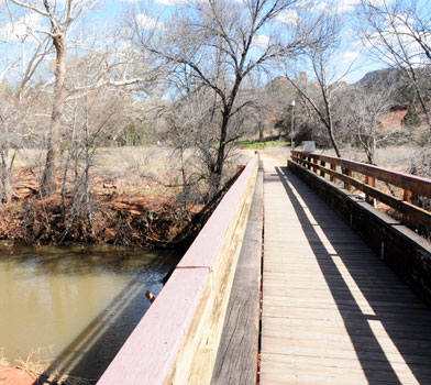
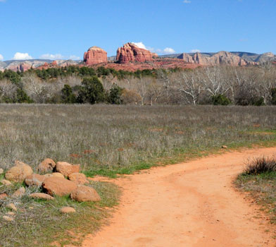
The Bunkhouse Trail is one of the more popular trails within the park and it is located a short distance away from the visitor center. The paved wheelchair friendly loop trail is also ideal for a family with young children. Enjoy the surrounding views of the House of Apache Fire and nearby rock formations while strolling along the trail. This was the location of an old homestead built in 1931 by Fritz Schuerman for his wife Dolly and their two children. For a longer hike, take a stroll across the Kingfisher Bridge which crosses Oak Creek and connects with many of the trails on the Red Rock five mile interconnecting loop system.


Elevation
The Bunkhouse Trail has a maximum elevation of 3,880 ft., a minimum elevation of 3,855 ft. and an elevation range of 25 ft.
Metrics
| [ A to B ] or [ B to A ] | |||
|---|---|---|---|
| Length 2 | Min Ele 3 | Max Ele 4 | Range 5 |
| 0.3 mi | 3,855 ft | 3,880 ft | 25 ft |
| [ A to B ] | |||
|---|---|---|---|
| Time 6 | Floors 7 | Gain 8 | Loss 9 |
| 8 min | 2.6 | 31 ft | 26 ft |
| [ B to A ] | |||
|---|---|---|---|
| Time | Floors | Gain | Loss |
| 8 min | 2.2 | 26 ft | 31 ft |
Calories
The following chart shows the total calories that you may expend on the trail while hiking in both directions. The chart is based on data derived from a statistical model of energy expenditure that relates gross weight, typical speed and trail topography.
Topo Maps
Download the PDF Bunkhouse Trail topo map and the adjoining quads to plan your hike. These are full-sheet, 7.5 Minute (1:24,000 scale) topographic maps.
Adjoining 7.5' Quadrangle Legend
- Northwest Topo Map: Loy Butte, AZ
- North Topo Map: Wilson Mountain, AZ
- Northeast Topo Map: Munds Park, AZ
- West Topo Map: Page Springs, AZ
- Topo Map: Sedona, AZ
- East Topo Map: Munds Mountain, AZ
- Southwest Topo Map: Cornville, AZ
- South Topo Map: Lake Montezuma, AZ
- Southeast Topo Map: Casner Butte, AZ
FAQ
What is the length of the Bunkhouse Trail?
The length of the trail is 0.3 miles (0.5 km) or 722 steps.
How long does it take to hike the Bunkhouse Trail?
A person in good physical health can hike the trail in 8 minutes in one direction and in 8 minutes in the opposite direction.
Warnings
Prevent tick bites: Treat clothing and gear, such as boots, pants, socks and tents with products containing 0.5% permethrin.
(cdc.gov)
- The Brown dog tick (Rhipicephalus sanguineus) may be present in this area. The Brown dog tick transmits Rocky Mountain Spotted Fever.
Footnotes
- Steps is a unit of distance equal to the sum of stride lengths that vary with the terrain.
- Length is the distance of the trail between the two trailheads, measured on the trail.
- Min Ele is the minimum elevation on the trail.
- Max Ele is the maximum elevation on the trail.
- Range is the difference between maximum and minimum elevation.
- Time is the typical total time required to hike the trail.
- Floors is the gain divided by twelve feet, the height of one floor.
- Gain (cumulative elevation gain) is the sum of every gain in elevation.
- Loss (cumulative elevation loss) is the sum of every loss in elevation.
