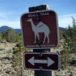
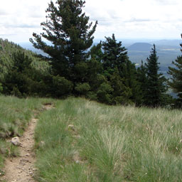
Beale Wagon Road Historic Trail,
Kaibab National Forest
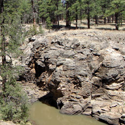
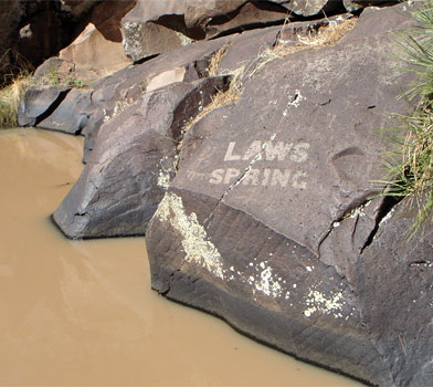
The Beale Wagon Road Historic Trail is accessible at Laws Spring in the Kaibab National Forest. This rare water supply was used by the prehistoric Cohonina people from AD 700 to 1100. The rock walls surrounding the spring have several petroglyphs dating from this time as well as many names inscribed of unknown immigrants who passed by the area during the 1800's.
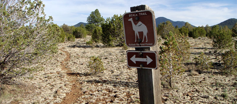
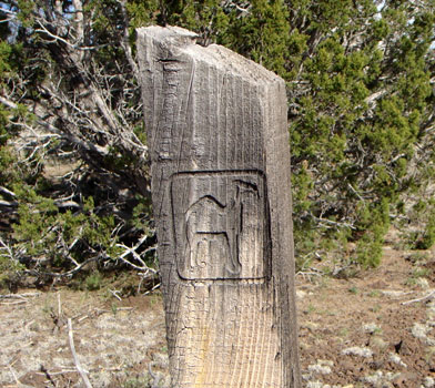
The trail is named after Edward Fitzgerald Beale who was a retired navy lieutenant hired by congress during 1857 to chart and build a transcontinental wagon road. The road provided pioneers with access to new territories gained after the 1848 Mexican-American war. With a team of 50 men, 22 camels and supplies of food and water, Beale endeavored to build a modest road that stretched 1,240 miles from Fort Smith, Arkansas to the Colorado River of Southern California.
Major W.L. Laws was a member of the military that escorted Lt. Beale and his men across the new land. As a sign of respect for the major, Lt. Beale named the spring after him in July 1859. The letters for "Laws Spring" were etched by Peachy Breckenridge, a tombstone carver who was also traveling with Beale's team. Peachy was the son of the then Vice President John C. Breckenridge who served under President Buchanan.
Laws Spring was listed on the National Register of Historical Places on July 5th, 1984. The spring has changed very little since Lt. Beale and the unknown immigrants passed by the area in the 1800's, the remains of the old wagon road are still faintly visible.
Please respect the area and do not deface the rocks. All artifacts on public lands are protected by federal and state laws. Note, trail metrics on this page cover a 2 mile section of the trail beginning at Laws Spring.
Elevation
The Beale Wagon Road Historic Trail has a maximum elevation of 6,945 ft., a minimum elevation of 6,807 ft. and an elevation range of 138 ft.
Metrics
| [ A to B ] or [ B to A ] | |||
|---|---|---|---|
| Length 2 | Min Ele 3 | Max Ele 4 | Range 5 |
| 1.9 mi | 6,807 ft | 6,945 ft | 138 ft |
| [ A to B ] | |||
|---|---|---|---|
| Time 6 | Floors 7 | Gain 8 | Loss 9 |
| 44 min | 11.2 | 134 ft | 0 ft |
| [ B to A ] | |||
|---|---|---|---|
| Time | Floors | Gain | Loss |
| 41 min | 0.0 | 0 ft | 134 ft |
Calories
The following chart shows the total calories that you may expend on the trail while hiking in both directions. The chart is based on data derived from a statistical model of energy expenditure that relates gross weight, typical speed and trail topography.
Topo Maps
Download the PDF Beale Wagon Road Historic Trail topo map and the adjoining quads to plan your hike. These are full-sheet, 7.5 Minute (1:24,000 scale) topographic maps.
Adjoining 7.5' Quadrangle Legend
- Northwest Topo Map: Howard Lake, AZ
- North Topo Map: Hobble Tank, AZ
- Northeast Topo Map: Ebert Mountain, AZ
- West Topo Map: Howard Mesa, AZ
- Topo Map: Cedar Mountain, CA
- East Topo Map: Moritz Ridge, AZ
- Southwest Topo Map: Williams North, AZ
- South Topo Map: Sitgreaves Mountain, AZ
- Southeast Topo Map: Parks, AZ
FAQ
Is this trail known by any other names?
Yes, this trail is also known as Beale Wagon Road Historic Trail #61.
What is the length of the Beale Wagon Road Historic Trail?
The length of the trail is 1.9 miles (3.0 km) or 4,047 steps.
How long does it take to hike the Beale Wagon Road Historic Trail?
A person in good physical health can hike the trail in 44 minutes in one direction and in 41 minutes in the opposite direction.
Warnings
Prevent tick bites: Treat clothing and gear, such as boots, pants, socks and tents with products containing 0.5% permethrin.
(cdc.gov)
- The Brown dog tick (Rhipicephalus sanguineus) may be present in this area. The Brown dog tick transmits Rocky Mountain Spotted Fever.
Footnotes
- Steps is a unit of distance equal to the sum of stride lengths that vary with the terrain.
- Length is the distance of the trail between the two trailheads, measured on the trail.
- Min Ele is the minimum elevation on the trail.
- Max Ele is the maximum elevation on the trail.
- Range is the difference between maximum and minimum elevation.
- Time is the typical total time required to hike the trail.
- Floors is the gain divided by twelve feet, the height of one floor.
- Gain (cumulative elevation gain) is the sum of every gain in elevation.
- Loss (cumulative elevation loss) is the sum of every loss in elevation.

