Bill Williams Mountain Trail,
Kaibab National Forest
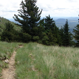
The trailhead for the Bill Williams Mountain Trail is located at the Williams District Ranger Station which is just a short drive from the Route 66 town of Williams. This steep trail has no switchbacks during the majority of the hike, it's not until the summit approaches that the switchbacks begin. Dense forest surrounds the trail. At the lower elevation there's an abundance of Gambel Oak and Ponderosa Pine, as the elevation increases the lush vegetation changes to Douglas Firs and Aspen which offer excellent shade during the heat of the summer months and an array of color during the fall.
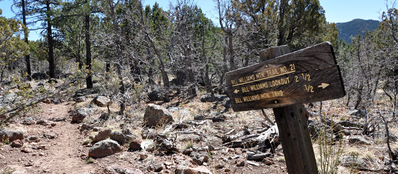
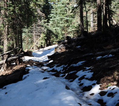
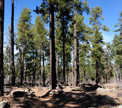
Once at the top of the mountain the scenery is impressive, 360 degree views of the Kaibab National Forest and the small town of Williams greet the hiker, making this steep mountain trail worth the climb to the top. On a clear day the views stretch for several miles.
At the top of Bill Williams Mountain is a 45 foot steel fire lookout tower. The Civilian Conservation Corp built the tower during 1937, There's also several communication towers adjacent to the lookout structure.
The hike down is easy considering the difficult ascent, either return down the same trail or arrange to meet a friend at the top and drive back down the mountain. The steep and winding graveled Forest Road 111 ends at the summit, the use of a four wheel drive vehicle is highly recommended.
Elevation
The Bill Williams Mountain Trail has a maximum elevation of 8,964 ft., a minimum elevation of 6,873 ft. and an elevation range of 2,091 ft.
Metrics
| [ A to B ] or [ B to A ] | |||
|---|---|---|---|
| Length 2 | Min Ele 3 | Max Ele 4 | Range 5 |
| 3.4 mi | 6,873 ft | 8,964 ft | 2,091 ft |
| [ A to B ] | |||
|---|---|---|---|
| Time 6 | Floors 7 | Gain 8 | Loss 9 |
| 2.1 hrs | 171.5 | 2,058 ft | 0 ft |
| [ B to A ] | |||
|---|---|---|---|
| Time | Floors | Gain | Loss |
| 1.4 hrs | 0.0 | 0 ft | 2,058 ft |
Calories
The following chart shows the total calories that you may expend on the trail while hiking in both directions. The chart is based on data derived from a statistical model of energy expenditure that relates gross weight, typical speed and trail topography.
Topo Maps
Download the PDF Bill Williams Mountain Trail topo map and the adjoining quads to plan your hike. These are full-sheet, 7.5 Minute (1:24,000 scale) topographic maps.
Adjoining 7.5' Quadrangle Legend
- Northwest Topo Map: Hearst Mountain, AZ
- North Topo Map: Williams North, AZ
- Northeast Topo Map: Sitgreaves Mountain, AZ
- West Topo Map: McLellan Reservoir, AZ
- Topo Map: Williams South, AZ
- East Topo Map: Davenport Hill, AZ
- Southwest Topo Map: Matterhorn, AZ
- South Topo Map: May Tank Pocket, AZ
- Southeast Topo Map: White Horse Lake, AZ
FAQ
Is this trail known by any other names?
Yes, this trail is also known as Bill Williams Mountain Trail #21.
What is the length of the Bill Williams Mountain Trail?
The length of the trail is 3.4 miles (5.4 km) or 7,568 steps.
How long does it take to hike the Bill Williams Mountain Trail?
A person in good physical health can hike the trail in 2.1 hours in one direction and in 1.4 hours in the opposite direction.
Warnings
Prevent tick bites: Treat clothing and gear, such as boots, pants, socks and tents with products containing 0.5% permethrin.
(cdc.gov)
- The Brown dog tick (Rhipicephalus sanguineus) may be present in this area. The Brown dog tick transmits Rocky Mountain Spotted Fever.
Footnotes
- Steps is a unit of distance equal to the sum of stride lengths that vary with the terrain.
- Length is the distance of the trail between the two trailheads, measured on the trail.
- Min Ele is the minimum elevation on the trail.
- Max Ele is the maximum elevation on the trail.
- Range is the difference between maximum and minimum elevation.
- Time is the typical total time required to hike the trail.
- Floors is the gain divided by twelve feet, the height of one floor.
- Gain (cumulative elevation gain) is the sum of every gain in elevation.
- Loss (cumulative elevation loss) is the sum of every loss in elevation.

