Pueblo Bonito Trail,
Chaco Culture National Historical Park
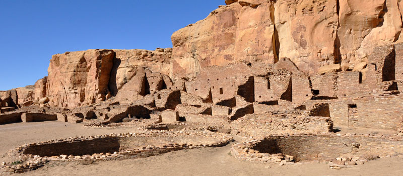
The Pueblo Bonito Trail is a short graveled trail that leads to what is considered to be the most important and thoroughly excavated of all the Chacoan sites at Chaco Culture National Historic Park.


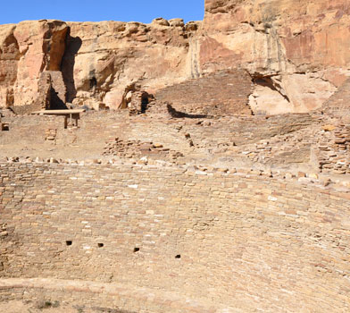
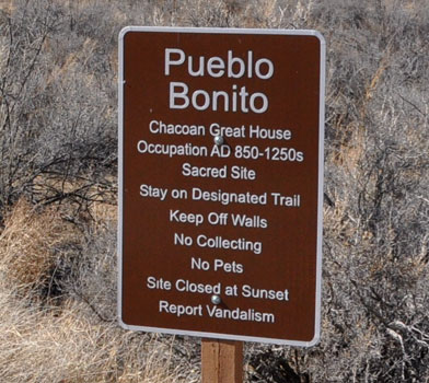
Construction of the Chacoan Great house commenced during 850AD and has undergone various phases of construction through to 1150AD — 600 rooms have been discovered which include over 30 Kivas and 2 Great Kivas used for rituals and ceremonies. Many rooms were designated for storage. Meeting rooms were used by travelers from other Puebloan communities and Chacoan families would also reside here, occupying three or four rooms per family.
There have been numerous excavations of this magnificent site over the years. The most important of the discoveries was conducted during 1896-1900 by Richard Wetherill and the philanthropist Hyde brothers. Many artifacts were uncovered, including flutes, pottery, bones and a sacred burial ground.
While exploring this structure, look at the rock wall located behind Pueblo Bonita — petroglyphs dating back to the 10th and 11th centuries depicting six toed feet and what the ancients considered to be their solar and lunar cycles can be seen.
Elevation
The Pueblo Bonito Trail has a maximum elevation of 6,166 ft., a minimum elevation of 6,131 ft. and an elevation range of 35 ft.
Metrics
| [ A to B ] or [ B to A ] | |||
|---|---|---|---|
| Length 2 | Min Ele 3 | Max Ele 4 | Range 5 |
| 0.5 mi | 6,131 ft | 6,166 ft | 35 ft |
| [ A to B ] | |||
|---|---|---|---|
| Time 6 | Floors 7 | Gain 8 | Loss 9 |
| 14 min | 2.5 | 30 ft | 21 ft |
| [ B to A ] | |||
|---|---|---|---|
| Time | Floors | Gain | Loss |
| 14 min | 1.8 | 21 ft | 30 ft |
Calories
The following chart shows the total calories that you may expend on the trail while hiking in both directions. The chart is based on data derived from a statistical model of energy expenditure that relates gross weight, typical speed and trail topography.
Topo Maps
Download the PDF Pueblo Bonito Trail topo map and the adjoining quads to plan your hike. These are full-sheet, 7.5 Minute (1:24,000 scale) topographic maps.
Adjoining 7.5' Quadrangle Legend
- Northwest Topo Map: Pretty Rock, NM
- North Topo Map: Pueblo Bonito NW, NM
- Northeast Topo Map: Kimbeto, NM
- West Topo Map: Kin Klizhin Ruins, NM
- Topo Map: Pueblo Bonito, NM
- East Topo Map: Sargent Ranch, NM
- Southwest Topo Map: Nose Rock, NM
- South Topo Map: Seven Lakes NW, NM
- Southeast Topo Map: Seven Lakes NE, NM
FAQ
What is the length of the Pueblo Bonito Trail?
The length of the trail is 0.5 miles (0.8 km) or 1,115 steps.
How long does it take to hike the Pueblo Bonito Trail?
A person in good physical health can hike the trail in 14 minutes in one direction and in 14 minutes in the opposite direction.
Warnings
Prevent tick bites: Treat clothing and gear, such as boots, pants, socks and tents with products containing 0.5% permethrin.
(cdc.gov)
- The Brown dog tick (Rhipicephalus sanguineus) may be present in this area. The Brown dog tick transmits Rocky Mountain Spotted Fever.
Footnotes
- Steps is a unit of distance equal to the sum of stride lengths that vary with the terrain.
- Length is the distance of the trail between the two trailheads, measured on the trail.
- Min Ele is the minimum elevation on the trail.
- Max Ele is the maximum elevation on the trail.
- Range is the difference between maximum and minimum elevation.
- Time is the typical total time required to hike the trail.
- Floors is the gain divided by twelve feet, the height of one floor.
- Gain (cumulative elevation gain) is the sum of every gain in elevation.
- Loss (cumulative elevation loss) is the sum of every loss in elevation.
