El Calderon Trail,
El Malpais National Monument
A visit to the El Malpais National Monument will not be a disappointment, this popular destination is a must for cavers, hikers and general backcountry exploration.
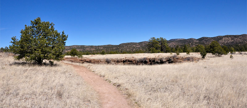
One hundred and fifteen thousand years ago a volcanic eruption formed the El Calderon Cinder Cone. Ponderosa Pine and Rocky Mountain Juniper now cover most of the volcanic terrain. The El Calderon Trail has much to offer outdoor enthusiasts. Lava tubes, two sinkholes and numerous caves are located here. The trail is graveled with little elevation gain and although it's marked with cairns, the geology of the land makes this a difficult trail to follow as the cairns blend in with the surrounding volcanic rock. The use of a GPS and map are strongly recommended while hiking the trails at El Malpais. For those that prefer to use a compass, please note that due to the iron rich deposits in the lava flows, the compass will probably not function correctly.
Caving is a very popular activity at EL Malpais National Monument. The Big Tubes area has one of the largest cave systems in North America. The El Calderon cave network begins at Cave Junction near the parking lot and picnic area.
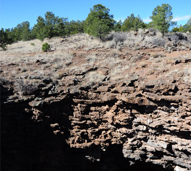
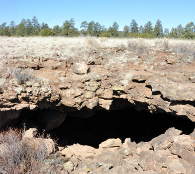
A short walk from Cave Junction leads to Double Sinks, both of these sinkholes have a depth of approximately 80 ft and there are no fences surrounding them. The first image at the top of this page shows the sinkhole on approach.


Elevation
The El Calderon Trail has a maximum elevation of 7,586 ft., a minimum elevation of 7,298 ft. and an elevation range of 288 ft.
Metrics
| [ A to B ] or [ B to A ] | |||
|---|---|---|---|
| Length 2 | Min Ele 3 | Max Ele 4 | Range 5 |
| 1.7 mi | 7,298 ft | 7,586 ft | 288 ft |
| [ A to B ] | |||
|---|---|---|---|
| Time 6 | Floors 7 | Gain 8 | Loss 9 |
| 49 min | 24.2 | 291 ft | 14 ft |
| [ B to A ] | |||
|---|---|---|---|
| Time | Floors | Gain | Loss |
| 44 min | 1.2 | 14 ft | 291 ft |
Calories
The following chart shows the total calories that you may expend on the trail while hiking in both directions. The chart is based on data derived from a statistical model of energy expenditure that relates gross weight, typical speed and trail topography.
Topo Maps
Download the PDF El Calderon Trail topo map and the adjoining quads to plan your hike. These are full-sheet, 7.5 Minute (1:24,000 scale) topographic maps.
Adjoining 7.5' Quadrangle Legend
- Northwest Topo Map: Valle Largo, NM
- North Topo Map: Paxton Springs, NM
- Northeast Topo Map: San Rafael, NM
- West Topo Map: Cerro Hueco, NM
- Topo Map: Ice Caves, NM
- East Topo Map: Arrosa Ranch, NM
- Southwest Topo Map: Cerro Brillante, NM
- South Topo Map: Ice Caves SE, NM
- Southeast Topo Map: North Pasture, NM
FAQ
What is the length of the El Calderon Trail?
The length of the trail is 1.7 miles (2.8 km) or 3,821 steps.
How long does it take to hike the El Calderon Trail?
A person in good physical health can hike the trail in 49 minutes in one direction and in 44 minutes in the opposite direction.
Warnings
Prevent tick bites: Treat clothing and gear, such as boots, pants, socks and tents with products containing 0.5% permethrin.
(cdc.gov)
- The Brown dog tick (Rhipicephalus sanguineus) may be present in this area. The Brown dog tick transmits Rocky Mountain Spotted Fever.
Footnotes
- Steps is a unit of distance equal to the sum of stride lengths that vary with the terrain.
- Length is the distance of the trail between the two trailheads, measured on the trail.
- Min Ele is the minimum elevation on the trail.
- Max Ele is the maximum elevation on the trail.
- Range is the difference between maximum and minimum elevation.
- Time is the typical total time required to hike the trail.
- Floors is the gain divided by twelve feet, the height of one floor.
- Gain (cumulative elevation gain) is the sum of every gain in elevation.
- Loss (cumulative elevation loss) is the sum of every loss in elevation.
